Camisa
Sivas · Archaeological site
Catalogue label
- Type
- Ancient city
- Kind
- Archaeological site
- Province / district
- Sivas
- Elevation
- 1,334 m
- Wikidata
- Q85750267
About
Camisa or Kamisa (Ancient Greek: τὰ Κάμισα), also known as Comassa and possibly as Eumeis, was a town of Lesser Armenia on the upper Halys River, east of modern Sivas, where the toponym survived into modern times as Kemiş. It was inhabited during Hellenistic, Roman, and Byzantine times. It loaned its name to the surrounding district of Camisene or Comisene; the fortress predated the building campaigns of Mithridates VI Eupator. Camisa was destroyed in Strabo's time, likely by Pompey in 66 BC. Following the Roman reorganization of the region, Mark Antony granted Kamisa and its surrounding district to Ateporix, a Galatian nobleman, who ruled until around 3 BC, after which the city was refounded as Sebastopolis. Salt was mined here in antiquity.
Text: Wikipedia, CC BY-SA 4.0 · Read more on Wikipedia
Location
Visiting here? The next 5 places nearby
The best-known places close by, in the shortest order from Camisa: about 242 km and 4 h 10 min of travel, plus roughly 6 h 30 min for the visits.
73 km · 1 h 13 min by car
 Kussara
Sivas
82 km · 1 h 22 min by car
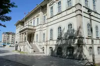
0.9 km · 11 min on foot
39 km · 39 min by car
 Bathys Rhyax
Sivas
47 km · 47 min by car
 Pedachtoë
Sivas
Directions for this routeDistances are straight-line estimates adjusted for roads; check each museum's hours before you go.
Wrong information?Tell usFix it on OpenStreetMap