Çayönü
Diyarbakır · Archaeological site
Photo: Krähenstein · CC BY-SA 3.0
Catalogue label
- Type
- Archaeology
- Kind
- Archaeological site
- Province / district
- Diyarbakır
- Elevation
- 834 m
- Wikidata
- Q272720
About
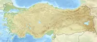
Çayönü Tepesi is a Pre-Pottery Neolithic B settlement in southeastern Turkey which prospered from around 8630 to 6800 BC. It is located in Diyarbakır 40 kilometres northwest of Diyarbakır, 140 kilometers northeast of Şanlıurfa, at the foot of the Taurus Mountains. It lies near the Boğazçay, a tributary of the upper Tigris River and the Bestakot, an intermittent stream. It is an early example of agriculture.
Text: Wikipedia, CC BY-SA 4.0 · Read more on Wikipedia
Location
Visiting here? The next 5 places nearby
The best-known places close by, in the shortest order from Çayönü: about 226 km and 4 h of travel, plus roughly 6 h for the visits.
70 km · 1 h 10 min by car
NorşuntepeElazığ
8.2 km · 8 min by car
 Arsamosata
Elazığ
146 km · 2 h 26 min by car
 Ziya Gökalp Museum
Diyarbakır
0.3 km · 3 min on foot
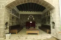 Ahmet Arif Literature Museum Library
Diyarbakır
0.9 km · 12 min on foot
 Diyarbakır Archeology Museum
Diyarbakır, Sur
Directions for this routeDistances are straight-line estimates adjusted for roads; check each museum's hours before you go.
Wrong information?Tell usFix it on OpenStreetMap