Hamaxitus
Çanakkale · Archaeological site
Photo: Leon petrosyan · CC BY-SA 4.0
Catalogue label
- Type
- Ancient city
- Kind
- Archaeological site
- Province / district
- Çanakkale
- Elevation
- 47 m
- Wikidata
- Q4822608
About
Hamaxitus (Ancient Greek: Ἁμαξιτός, romanized: Hamaxitos) was an ancient Greek city in the south-west of the Troad region of Anatolia which was considered to mark the boundary between the Troad and Aeolis. Its surrounding territory was known in Greek as Ἁμαξιτία (Hamaxitia), and included the temple of Apollo Smintheus, the salt pans at Tragasai, and the Satnioeis river (modern Tuzla Çay). It was probably an Aeolian colony.
Text: Wikipedia, CC BY-SA 4.0 · Read more on Wikipedia
Location
Visiting here? The next 5 places nearby
The best-known places close by, in the shortest order from Hamaxitus: about 116 km and 1 h 55 min of travel, plus roughly 7 h for the visits.
30 km · 30 min by car
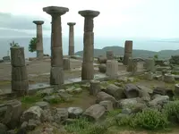 Assos
AssosÇanakkale
37 km · 37 min by car
 Neandreia
Çanakkale
14 km · 14 min by car
 Kolonai
Çanakkale
9.7 km · 10 min by car
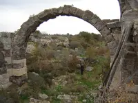 Alexandria Troas
Çanakkale
25 km · 25 min by car
 Achilleion
Çanakkale
Directions for this routeDistances are straight-line estimates adjusted for roads; check each museum's hours before you go.
Wrong information?Tell usFix it on OpenStreetMap