Orestias
Edirne · Archaeological site
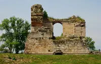
Photo: Dosseman · CC BY-SA 4.0
Catalogue label
- Type
- Ancient city
- Kind
- Archaeological site
- Province / district
- Edirne
- Elevation
- 63 m
- Wikidata
- Q7101665
About
Orestias (Greek: Ὀρεστιάς), later refounded by Hadrian as Adrianople (Greek: Άδριανούπολις), was an ancient Greek settlement next to the Evros river in Thrace, near or at the site of present-day Edirne, and close to the current border between Turkey and Greece.
Text: Wikipedia, CC BY-SA 4.0 · Read more on Wikipedia
Location
Visiting here? The next 5 places nearby
The best-known places close by, in the shortest order from Orestias: about 91 km and 1 h 35 min of travel, plus roughly 5 h 30 min for the visits.
5.5 km · 5 min by car
0.3 km · 4 min on foot
5.9 km · 6 min by car
1.6 km · 2 min by car
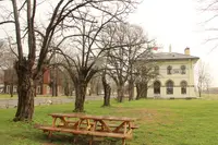
 Edirne Palace
Edirne
78 km · 1 h 18 min by car
 Kırklareli Museum
Kırklareli
Directions for this routeDistances are straight-line estimates adjusted for roads; check each museum's hours before you go.
Wrong information?Tell usFix it on OpenStreetMap