Virasia
Amasya · Archaeological site
Catalogue label
- Type
- Ancient city
- Kind
- Archaeological site
- Province / district
- Amasya
- Elevation
- 594 m
- Wikidata
- Q85813279
About
Virasia was a town in the west of ancient Pontus, inhabited in Byzantine times. According to the Tabula Peutingeriana it was on the road from Antoniopolis through Anadynata to Amasia, 16 M.P. from the latter.
Text: Wikipedia, CC BY-SA 4.0 · Read more on Wikipedia
Location
Visiting here? The next 5 places nearby
The best-known places close by, in the shortest order from Virasia: about 234 km and 4 h 5 min of travel, plus roughly 6 h 30 min for the visits.
30 km · 30 min by car
 Amasya Museum
Amasya
0.9 km · 12 min on foot
47 km · 47 min by car
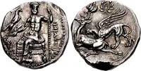 Gaziura
Tokat
100 km · 1 h 40 min by car
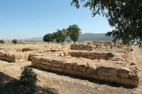 Sapinuwa
Çorum
56 km · 56 min by car

Directions for this routeDistances are straight-line estimates adjusted for roads; check each museum's hours before you go.
Wrong information?Tell usFix it on OpenStreetMap