Satala
Gümüşhane, Kelkit · Archaeological site
Photo: Carole Raddato · CC BY-SA 2.0
Catalogue label
- Type
- Ancient city
- Kind
- Archaeological site
- Province / district
- Gümüşhane / Kelkit
- Elevation
- 1,752 m
- Wikidata
- Q2211116
About
Located in Turkey, the settlement of Satala (Old Armenian: Սատաղ Satał, Ancient Greek: Σάταλα), according to the ancient geographers, was situated in a valley surrounded by mountains, a little north of the Euphrates, where the road from Trapezus to Samosata crossed the boundary of the Roman Empire, when it was a bishopric, which remains a Latin Catholic titular see. Later it was connected with Nicopolis by two highways. Satala is now Sadak, a village of 348 inhabitants (2022), in the Kelkit District of Gümüşhane Province in Turkey.
Text: Wikipedia, CC BY-SA 4.0 · Read more on Wikipedia
Location
Visiting here? The next 5 places nearby
The best-known places close by, in the shortest order from Satala: about 212 km and 3 h 30 min of travel, plus roughly 6 h 30 min for the visits.
44 km · 44 min by car
 Erzincan Museum
Erzincan
21 km · 21 min by car
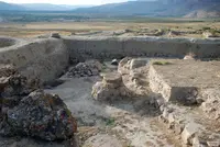 Altıntepe
Erzincan
58 km · 58 min by car
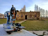 Kenan Yavuz Museum of Ethnography
Bayburt, Demirözü
28 km · 28 min by car
Büyüktepe MoundBayburt, Demirözü
61 km · 1 h 1 min by car
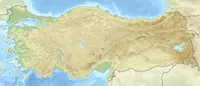 Patara
Gümüşhane
Directions for this routeDistances are straight-line estimates adjusted for roads; check each museum's hours before you go.
Wrong information?Tell usFix it on OpenStreetMap