Aşıklı Höyük
Aksaray · Archaeological site
Photo: Katpatuka · CC BY-SA 3.0
Catalogue label
- Type
- Archaeology
- Kind
- Archaeological site
- Province / district
- Aksaray
- Elevation
- 1,116 m
- Wikidata
- Q794830
About
Aşıklı Höyük is a settlement mound located nearly 1 kilometre (0.62 mi) south of Kızılkaya village on the bank of the Melendiz brook, and 25 km (16 mi) southeast of Aksaray, Turkey.
Text: Wikipedia, CC BY-SA 4.0 · Read more on Wikipedia
Location
Visiting here? The next 5 places nearby
The best-known places close by, in the shortest order from Aşıklı Höyük: about 183 km and 3 h 5 min of travel, plus roughly 7 h for the visits.
49 km · 49 min by car
PurushandaAksaray
61 km · 1 h 1 min by car
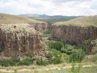 Ihlara Valley
Aksaray
2.9 km · 3 min by car
 Ihlara
Aksaray
56 km · 56 min by car
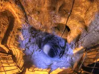 Derinkuyu underground city
Nevşehir, Derinkuyu ilçesi
14 km · 14 min by car
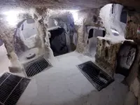 Kaymakli Underground City
Nevşehir
Directions for this routeDistances are straight-line estimates adjusted for roads; check each museum's hours before you go.
Wrong information?Tell usFix it on OpenStreetMap