Ihlara
Aksaray · Archaeological site
Catalogue label
- Type
- Archaeology
- Kind
- Archaeological site
- Province / district
- Aksaray
- Elevation
- 1,276 m
- Wikidata
- Q1366229
About
Ihlara, formerly known as Chliára (Cappadocian Greek: Χλιάρα; Latin: Chliará) is a town (belde) and municipality in the Güzelyurt District, Aksaray Province, Turkey. The population is 2,289 (2021). It is situated at about 40 km (25 mi) from the province seat of Aksaray and near the town of Güzelyurt. The township is famed for the nearby valley of the same name, Ihlara Valley, which is a 16 km (10 mi) long gorge cut into volcanic rock in the southern part of Cappadocia, following several eruptions of Mount Erciyes. The Melendiz River flows through the valley.
Text: Wikipedia, CC BY-SA 4.0 · Read more on Wikipedia
Location
Visiting here? The next 5 places nearby
The best-known places close by, in the shortest order from Ihlara: about 151 km and 2 h 30 min of travel, plus roughly 7 h for the visits.
2.9 km · 3 min by car
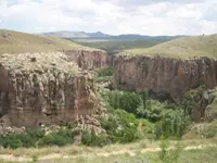 Ihlara Valley
Aksaray
16 km · 16 min by car
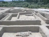 Aşıklı Höyük
Aksaray
21 km · 21 min by car
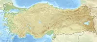 Nora
NoraAksaray
47 km · 47 min by car
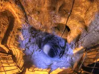 Derinkuyu underground city
Nevşehir, Derinkuyu ilçesi
64 km · 1 h 4 min by car
Directions for this routeDistances are straight-line estimates adjusted for roads; check each museum's hours before you go.
Wrong information?Tell usFix it on OpenStreetMap