Ihlara Valley
Aksaray · Archaeological site
Catalogue label
- Type
- Archaeology
- Kind
- Archaeological site
- Province / district
- Aksaray
- Elevation
- 1,209 m
- Wikidata
- Q22343387
About
The Ihlara Valley (or Peristrema Valley; Turkish Ihlara Vadisi) is a canyon which is 15 km long and up to 150 m deep in the southwest of the Turkish region of Cappadocia, in the municipality of Güzelyurt, Aksaray Province. The valley contains around 50 rock-hewn Christian churches and numerous rock-cut buildings.
Text: Wikipedia, CC BY-SA 4.0 · Read more on Wikipedia
Location
Visiting here? The next 5 places nearby
The best-known places close by, in the shortest order from Ihlara Valley: about 170 km and 2 h 50 min of travel, plus roughly 7 h 30 min for the visits.
2.9 km · 3 min by car
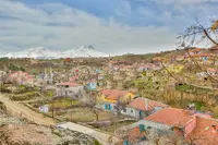 Ihlara
Aksaray
9.7 km · 10 min by car
 Nora
NoraAksaray
47 km · 47 min by car
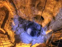 Derinkuyu underground city
Nevşehir, Derinkuyu ilçesi
62 km · 1 h 2 min by car
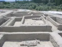 Aşıklı Höyük
Aksaray
49 km · 49 min by car
PurushandaAksaray
Directions for this routeDistances are straight-line estimates adjusted for roads; check each museum's hours before you go.
On these itineraries
- Three Days in Cappadocia · 3 days · about 11 h 5 min
Wrong information?Tell usFix it on OpenStreetMap